Posted by PuertoMadero in Uncategorized | 0 Comentarios
NUBES MAMATUS: Aporte Hna. Norma M.
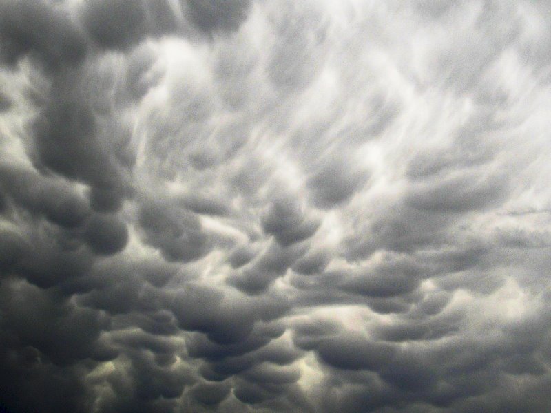
Check out these mammatus clouds
Mammatus clouds can appear ominous. But, in a way that’s so common in nature, their dangerous aspect goes hand in hand with a magnificent beauty.

Mammatus clouds in New Jersey. June 21, 2016. Image via Phil Chillemi.
Mammatus clouds are pouch-like protrusions hanging from the undersides of clouds, usually thunderstorm anvil clouds but other types of clouds as well. Composed primarily of ice, these cloud pouches can extend hundreds of miles in any direction, remaining visible in your sky for perhaps 10 or 15 minutes at a time. People associate them with severe weather, and it’s true they can appear around, before or after a storm. Contrary to myth, they don’t continue extending downward to form tornados, but they are interesting in part because they’re formed by sinking air. Most clouds are formed by rising air. Mammatus clouds can appear ominous. But, in a way that’s so common in nature, their dangerous aspect goes hand in hand with a magnificent beauty.

Mammatus clouds via Andrew Hill in Gloucestershire, UK.

Crystal Kolb caught these mammatus clouds from Essex, Maryland – near Baltimore – after a bad storm.

Mammatus clouds at sunset submitted to EarthSky by Andrew Ashton in Nampa, Idaho.

Josh Blash caught these mammtus clouds illuminated by lightning over Rye, New Hampshire.

From Lorrie Wy, who wrote in May, 2014, “Bubbley clouds over central Alberta, approximately 9:20 p.m. Temp approximately plus 12. Winds cold and light from north west. These clouds just rolled right over.”

Berit Roaldseth in Trondheim, Norway saw these mammtus clouds after an April rain shower.

Mammatus clouds over Fayetteville, Arkansas just before sunset. Image via Mike Price.

Mammatus clouds over Fort Worth, Texas in May, 2013 – the day a tornado struck near Oklahoma City. Photo viaSundog Art Photography

Pam Rice Phillips caught the same mammatus clouds as in the image above, on May 20, 2013, the day the tornado struck Moore, Oklahoma. She was in Granbury, Texas, which is southwest of Fort Worth.

Mammatus clouds over Tynemouth, England, via Colin Cooper.

Mammatus clouds over Salt Lake City, Utah from Shanna Dennis.
Mammatus clouds over Denver in 2012 via EarthSky blogger Larry Sessions.

Mammatus clouds over Half Dome in Yosemite National Park in June, 2013 by friend Kristal Leonard.
Enjoying EarthSky so far? Sign up for our free daily newsletter today!
Bottom line: A spectacular collection of photos of mammatus clouds.